
See more. Climb less.
Professional aerial imagery helps owners and teams document hard-to-reach areas, understand visible conditions, and communicate clearly.

Telecommunications infrastructure
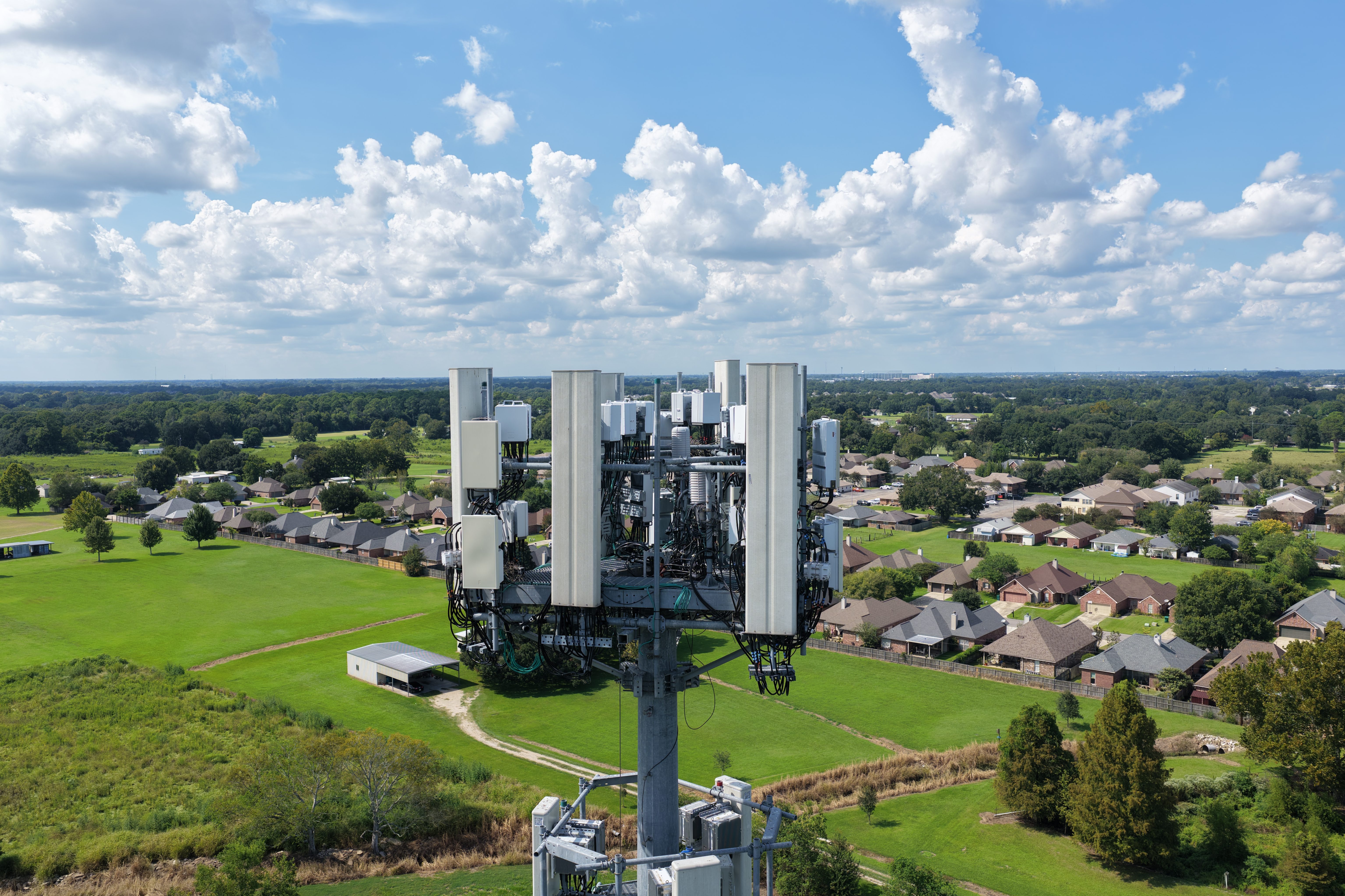
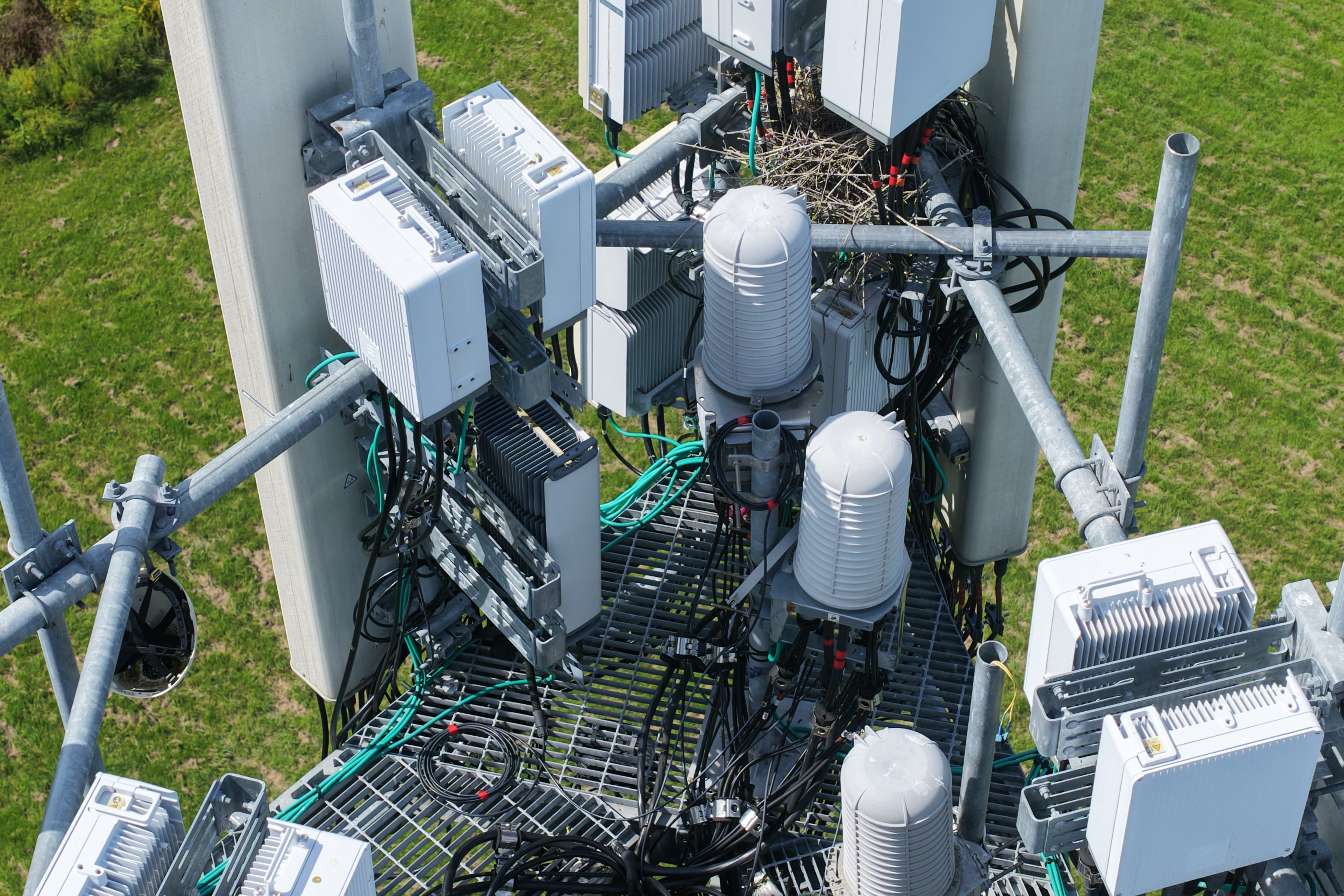
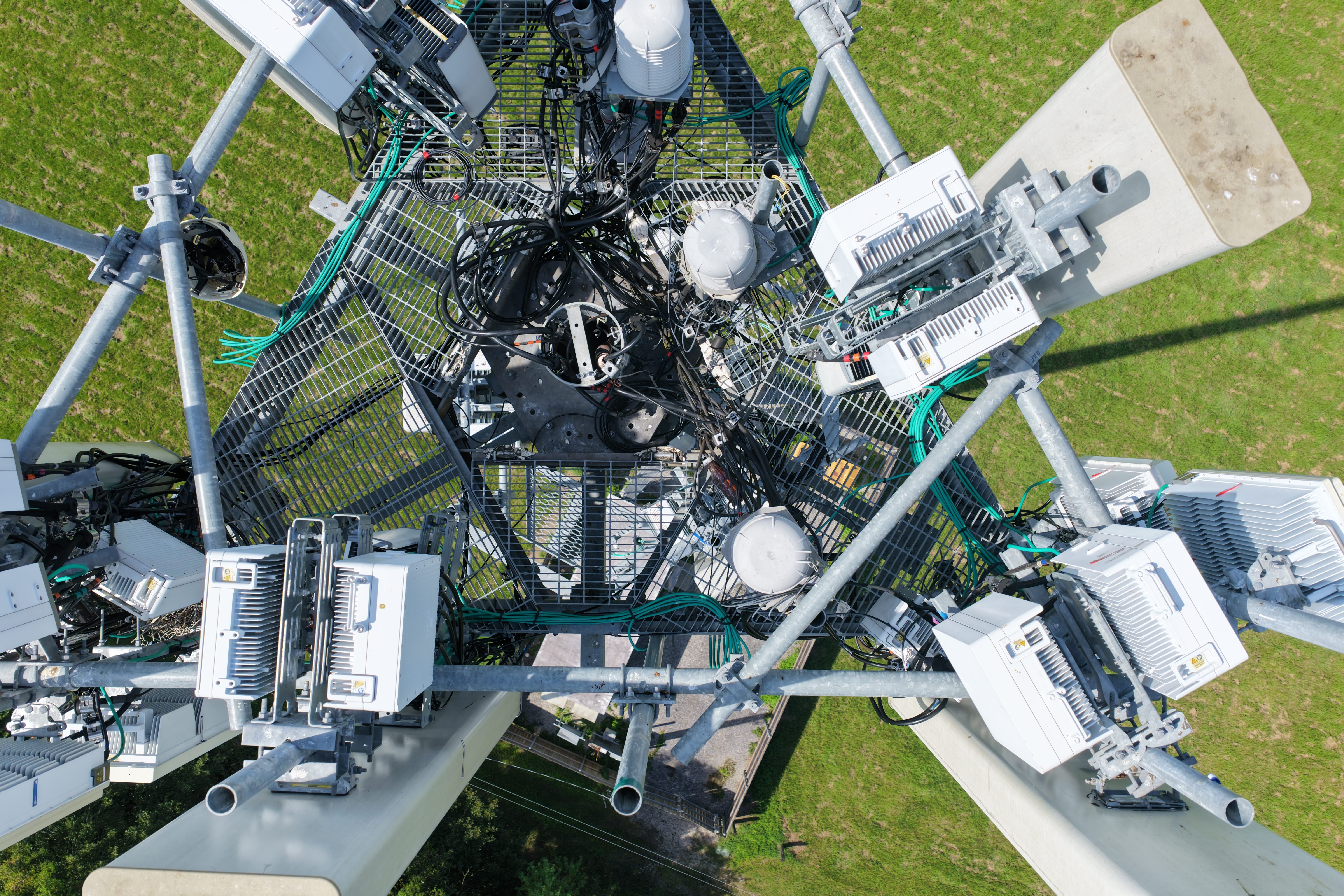
High-resolution aerial documentation provides both overall site context and close visual detail of elevated equipment, mounting systems, cabling, and access areas.
Useful visual documentation without unnecessary exposure
Drone imagery can help teams review elevated and hard-to-reach assets while reducing the need for routine access at height.
Roof and exterior documentation
Capture visible roof surfaces, flashing, drainage features, facades, and exterior conditions.
Commercial and industrial sites
Document facilities, equipment, structures, yards, and surrounding access conditions.
Construction progress
Create consistent visual records for owners, contractors, and stakeholders.
Property and site overview
Show context, boundaries, approaches, and nearby features from an elevated perspective.
Commercial, industrial, offshore, and facility documentation.

Every quote is based on the actual scope.
Site conditions, access, airspace, deliverables, travel, and scheduling can affect the work. Tell us what needs to be documented and we will respond with a clear project-specific quote.